Weekly Labs
- Lab 1 - Week 1
- Lab 2 - Week 2
- Lab 3 - Week 3
- Lab 4 - Week 4
- Lab 5 - Week 5
- Lab 6 - Week 6
- Lab 7 - Week 7
- Lab 8 - Week 8
- Lab 9 - Week 9
- Lab 10 - Week 10
- Lab 11 - Week 11
- Lab 12 - Week 12
- Lab 13 - Week 13
Weekly Labs
Class LinksAboutOptional notesSpace for optional news or links. |
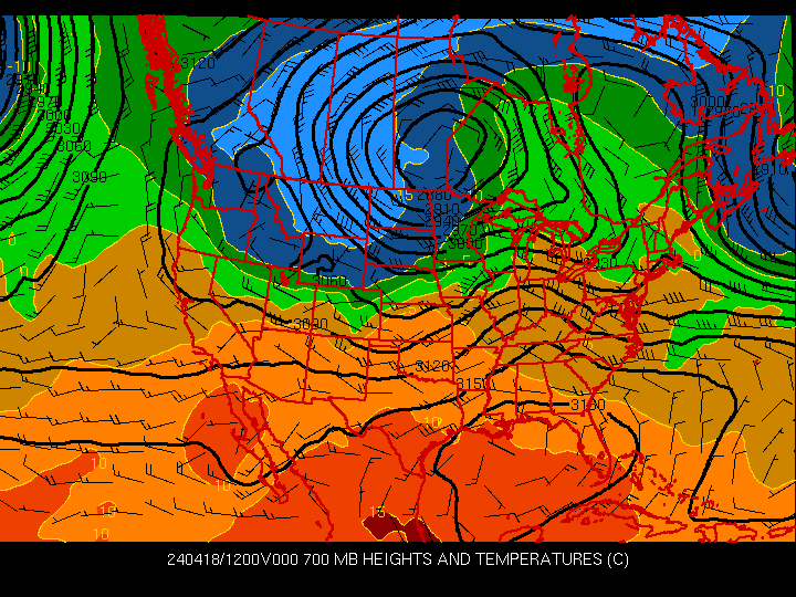
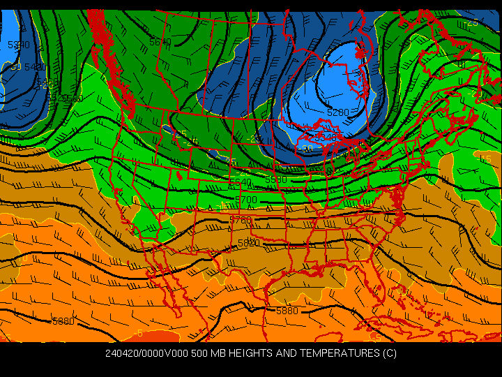
Week 6 - Quasigeostrophic Theory - QG Height Tendency Equation
One of the most powerful and heavily used approximations in operational meteorology is QG Theory. If one assumes the atmosphere is hydrostatic and mostly geostrophic (but allowing for some divergence effects), it can be shown that differential vorticity advection and horizontal temperature advection have a direct impact on vertical motion and height tendencies. Just remember, these approximations apply to large scales. The output of modern high-resolution forecast models may not be well-suited to applying QG Theory.
Estimate how height values will change in the next 12 hours by using your 700 mb map and a 500 mb map. Note that cold advection (warm) at 700 mb and positive (negative) vorticity advection at 500 mb should result in falling (rising) 500 mb heights. |
Copyright © 2008, Iowa State University of Science and Technology. All rights reserved.