|
|
Interesting Articles
IEM Climodat Reports
Class Presentations
Class Images
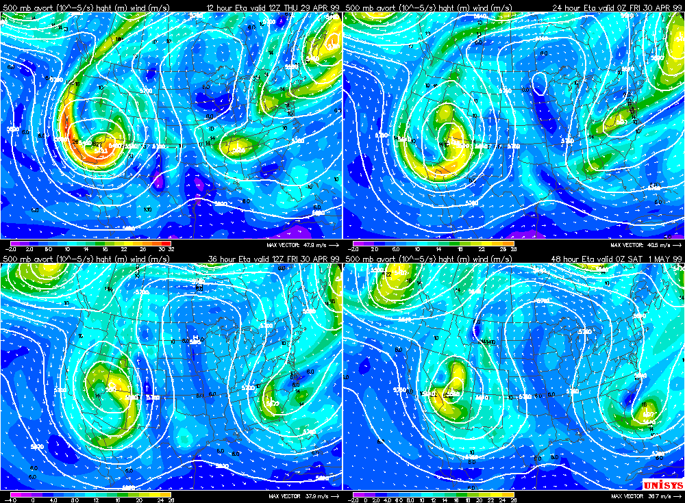
Blocks
Class Facts
10+ inch daily snowfall events for Ames:
- 11" | 1899-12-11
- 18" | 1900-03-05
- 11.2" | 1909-03-09
- 12" | 1928-11-30
- 12" | 1939-02-28
- 12" | 1996-01-26
- 10.2" | 1997-02-04
- 12" | 1998-03-08
Top November snow events for Ames and Des Moines
Ames
- 1928-11-30 | 12"
- 1934-11-30 | 10"
- 1957-11-18 | 9.5"
- 1991-11-23 | 7"
- 1918-11-28 | 6.5"
- 1983-11-23 | 6"
- 1932-11-08 | 5.8"
Des Moines
- 1968-11-10 | 11.8"
- 1992-11-25 | 9.3"
- 1893-11-30 | 8"
- 1972-11-13 | 7.5"
- 1928-11-30 | 6.9"
- 1918-11-28 | 6.5"
- 1932-11-08 | 5.7"
- 1985-11-30 | 5.6"
- 1934-11-30 | 5.6"
- 1991-11-23 | 5.2"
- 1957-11-18 | 5.2"
- 1971-11-28 | 5.2"
Class Definitions
- Dendritic growth layer: Typically between -10 and -20 C. This layer is favorable for dendritic snowflake (large snow flakes) formation if there is sufficient vertical motion and moisture.
- Omega - Vertical motion: dP/dt, or the how fast pressure changes with time. Sign is opposite of vertical velocity, w, which is dZ/dt.
Meteorological Software Links
|
Weather News
Daily Weather Story
|
|
|
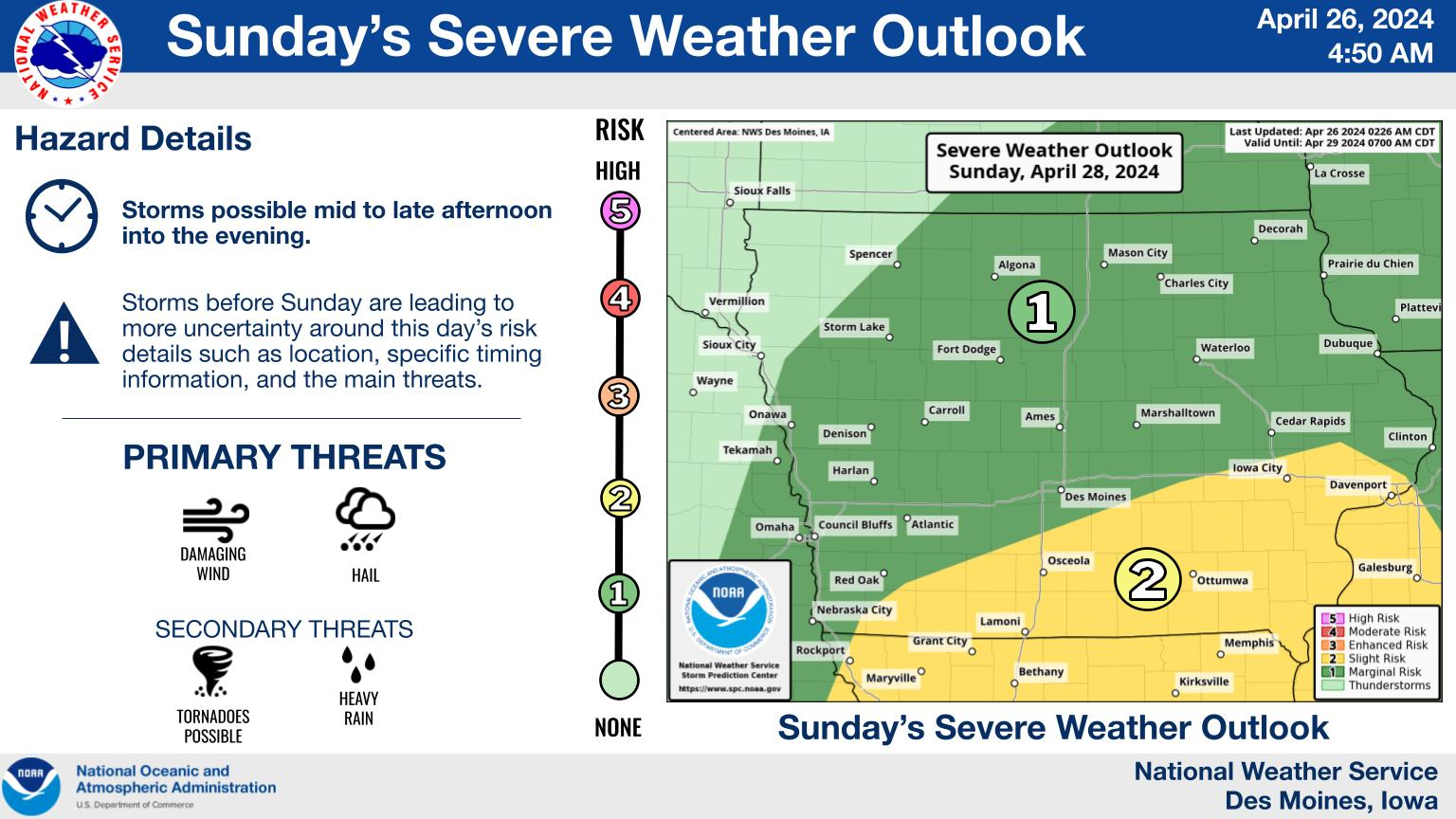
Click the image to see the most recent NWS weather story for central Iowa.
|
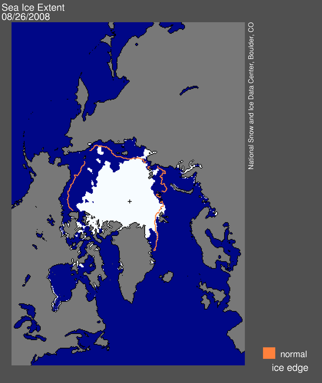
Low on Ice
|
|
|
How does the current sea ice extent compare to the past?
|
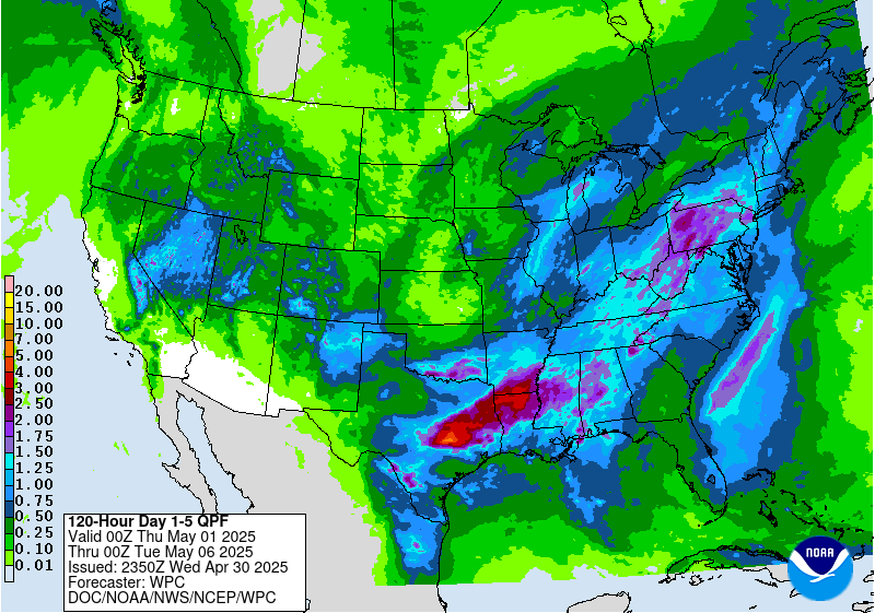
5-Day QPF
|
|
|
Where is it going to rain or snow in the next week? See the five day QPF from HPC.
|
Drought Monitor
|

|
|
How this outlook impacts the current drought situation? See the latest drought monitor.
|
|
Fall 2020
|
|