Go back to forecast sheet by clicking on the BACK button at the top of this window
|
|
|
| Satellite observations display existing cloud conditions. The visible picture gives a "camera shot" from space during the day. The infrared measures temperatures of the cloud tops (useful during the day or night). Water vapor shows the percentage of water vapor existing through the atmosphere. |
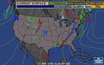
| Surface maps display various surface parameters such as pressure, temperature, and dewpoint temperature. Lows, highs, and fronts are drawn on some maps to indicate varying surface conditions. These can be used to track areas of low pressure (usually producing cloudiness and precipitation) and high pressure (usually clearer weather). |
|
|
Surface progs are manually drawn maps based on computer model data. These maps show the position of fronts and probable areas of precipitation 12 and 24 hours from the initial time. |
|
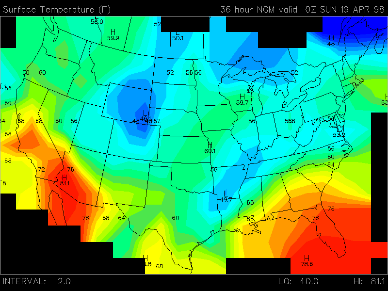
Computer models use current weather conditions to project how conditions willchange in the coming hours and days. The model output must be interpreted, since few normal surface features are drawn on the maps. These are computer projections and not always correct. These are good to use for a guide but adaptations must be made. |
Revised: 9 Jan 1998
Send comments and suggestions to:
Doug
Yarger (doug@iastate.edu) or Pete
Boysen (pboysen@iastate.edu)
Copyright © 1996,
Iowa State University, All Rights reserved